The PLUM™ 2.0 device
Purple and green Intelligent Mapping™ Logo

PLUM™ 1.25

MAP ACCURATELY AND QUICKLY

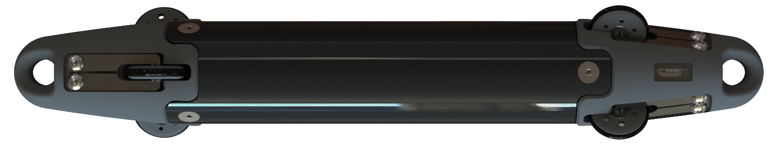
Dimension: Fits in a 1.25" pipe

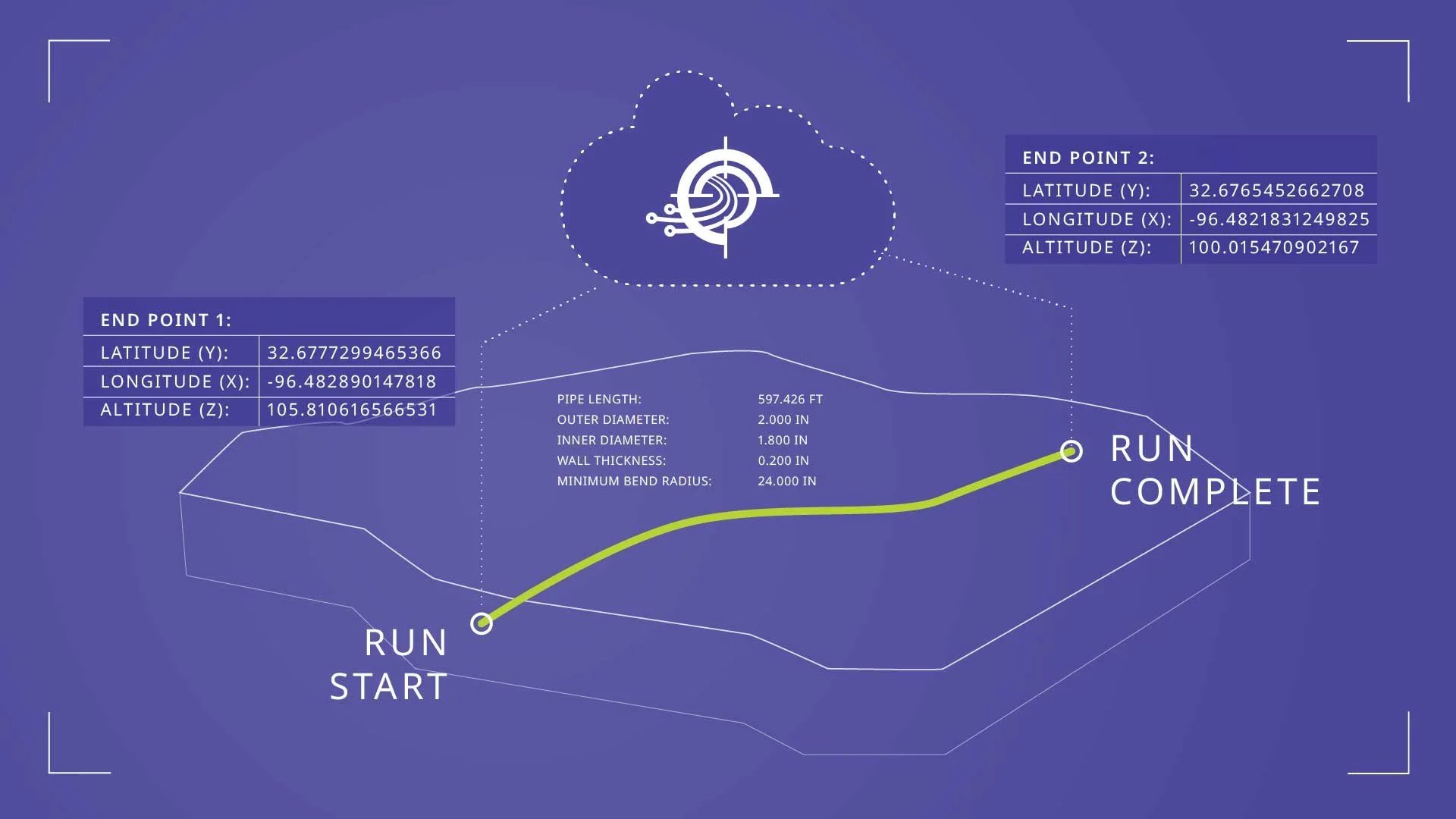
The PLUM™ 1.25 and proprietary software allows for the creation of three-dimensional maps of underground systems and captures the X, Y, and Z coordinates.


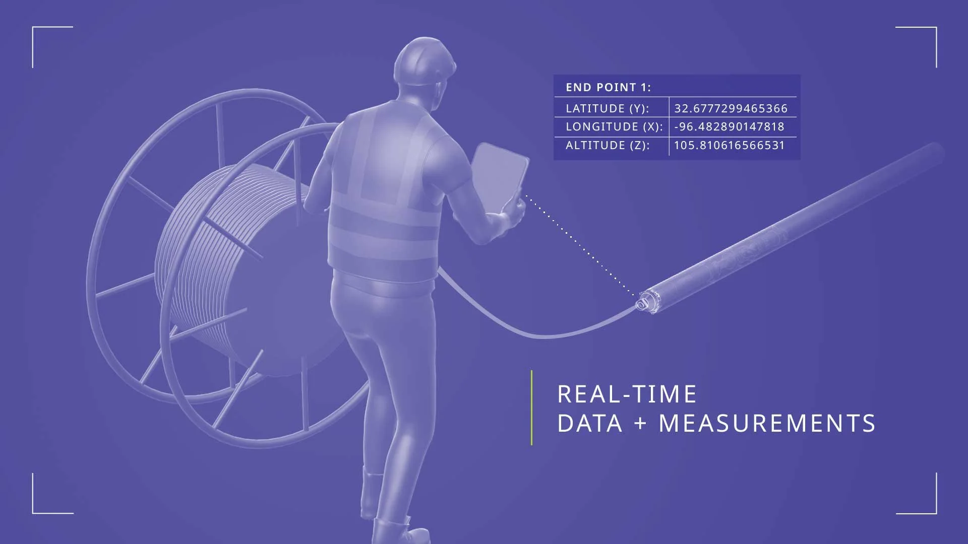
The newly developed PLUM™ 1.25 utilizes secure cloud software that provides real-time data processing, automatic report generation, and archives of all related data. Our sensors and proprietary software are integrated into a platform that generates a report detailing the X, Y, and Z coordinates and potential bend radius issues, and provides source data that is communicated to the GIS platforms.

THE PROCESS

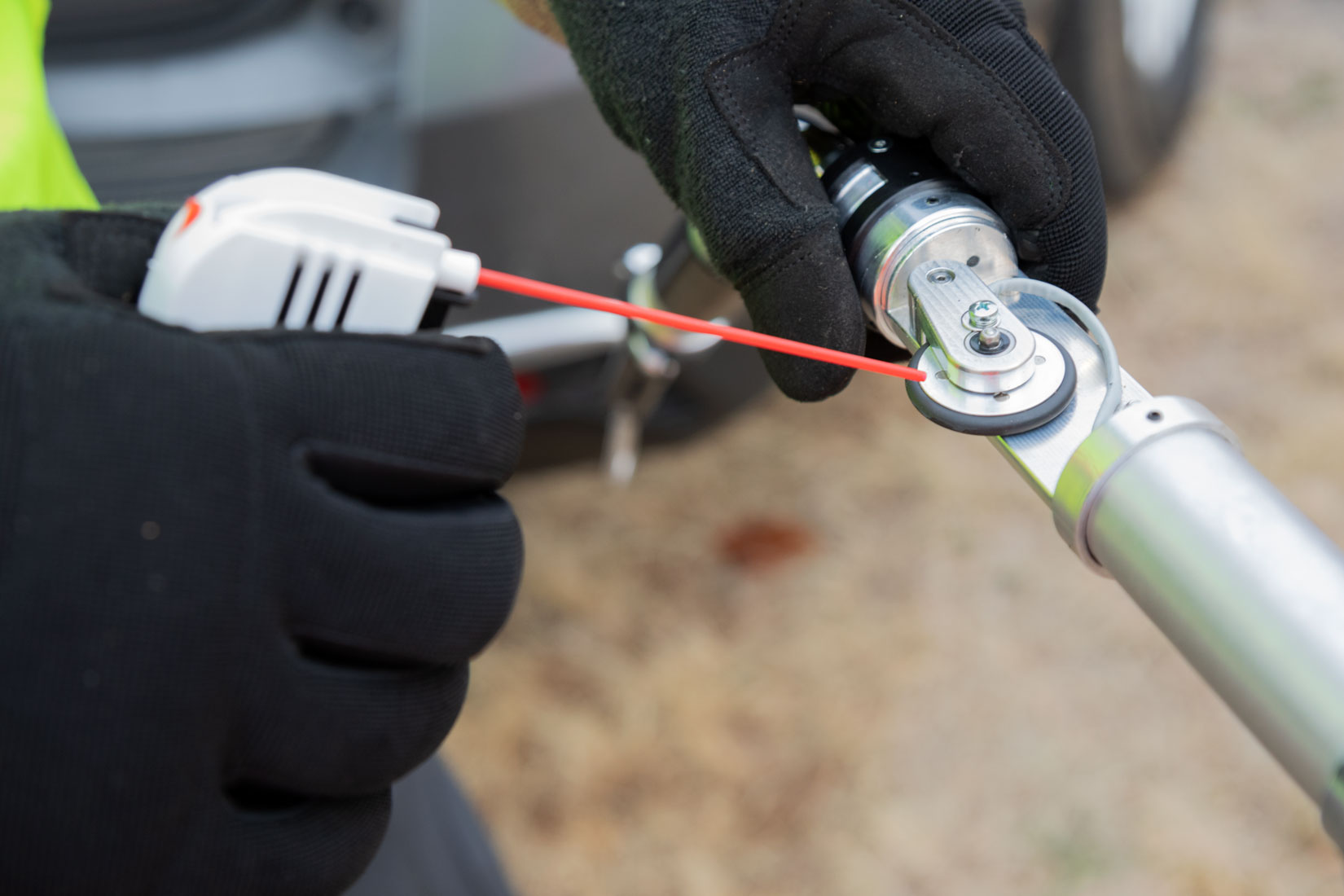
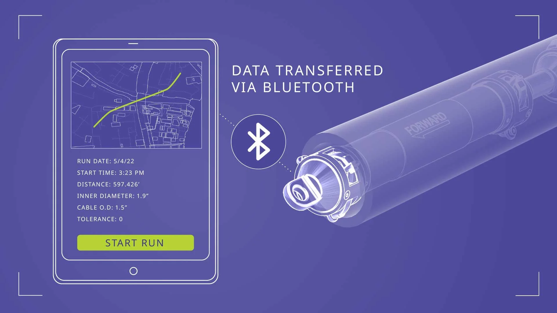
Setup is simple. The PLUM™ is designed by field engineers for operators in the field. The PLUM™ 1.25 can be either blown through a pipe or conduit or connected to pull tape that is then connected to a winch operated by a field technician. The device delivers real-time on-site data and measurements of the desired pipe or conduit. Data is anchored to GPS endpoints via a GPS device. Data is then transmitted from the device to a secure cloud platform. Proprietary data is protected with encryption at every step of the process.

A digital illustration of a worker in safety gear measuring a pipe with real-time data and measurements displayed on a screen, including GPS coordinates and altitude.
A digital interface showing a drone flight plan from start to finish. The plan tracks latitude, longitude, and altitude, with details on pipe dimensions and coordinates. The route curves from a starting point labeled "RUN START" to an endpoint labeled "RUN COMPLETE." Additional data and coordinates are displayed in blue boxes.
Digital illustration showing a tablet with running data, a Bluetooth symbol, and a mechanical part. The data includes run date, start time, distance, inner diameter, cable outer diameter, and tolerance, with a green "START RUN" button. The phrase "DATA TRANSFERRED VIA BLUETOOTH" is displayed.
Graphic box with the text 'Provides survey grade accuracy'.

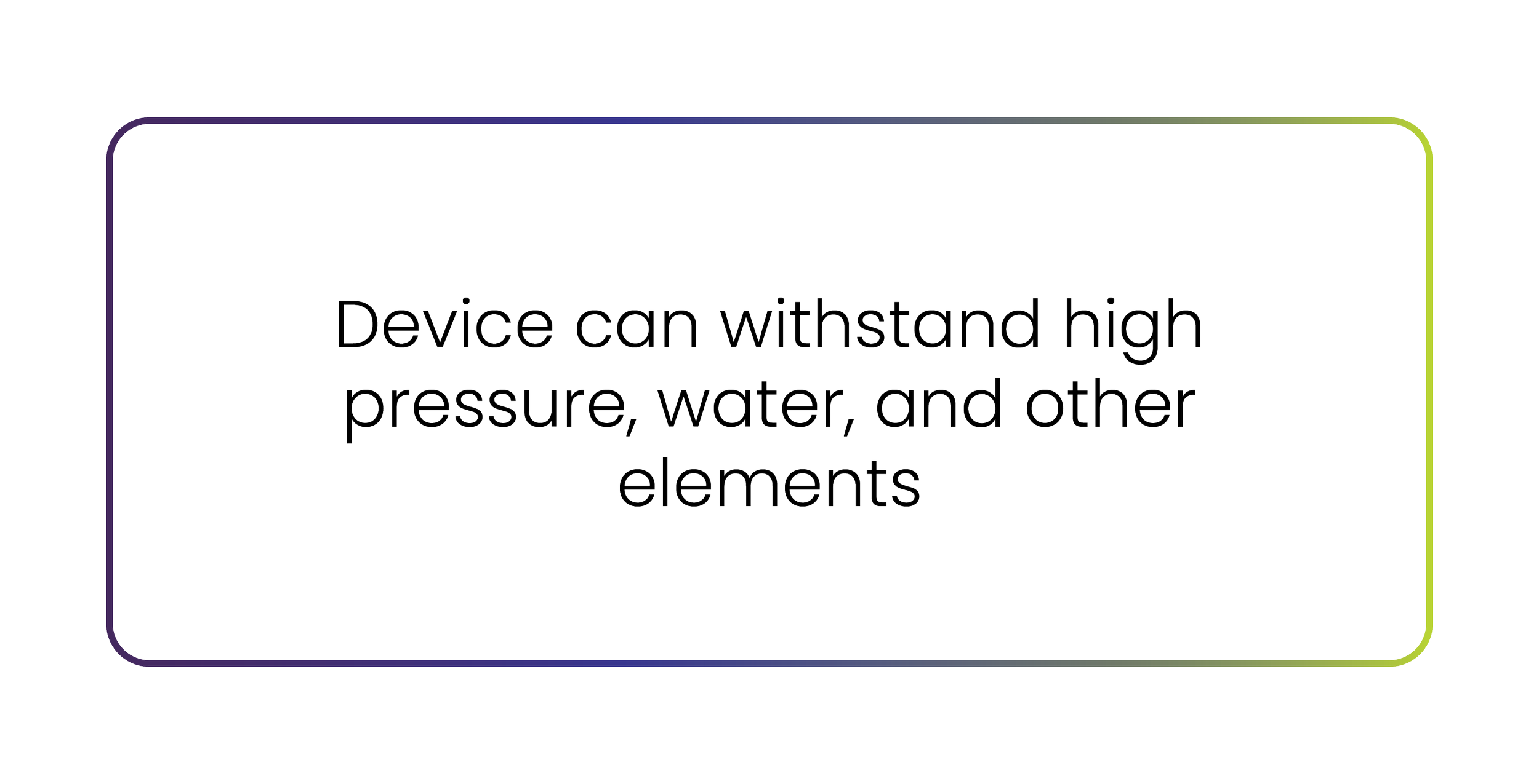
TECHNICAL CAPABILITIES

Graphic box with the text 'Data can be collected over a single-pass through system' inside a rectangular outline with a gradient border.
Graphic box with the text 'High-output port and wireless technology allow quick uploading to the cloud'.
Graphic box with the text 'Data output capability: CSV, KML, JSON, and SHP files' on a white background with a rounded border.
Graphic box with the text 'Device can withstand high pressure, water, and other elements'.
Purple and green Intelligent Mapping™ Logo

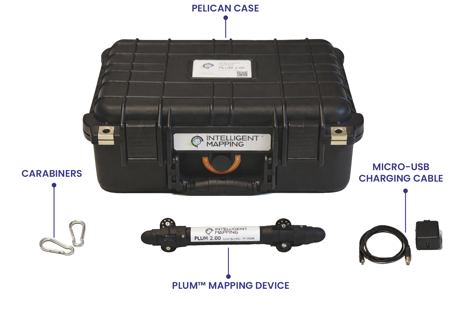
SHIPPED IN A CASE THAT INCLUDES:

A black pelican case containing an Intelligent Mapping device, a Plum mapping device, carabiners, a micro-USB charging cable, and a power adapter.

READY TO MAP SMARTER?

TURN UNDERGROUND UNCERTAINTY INTO DATA-DRIVEN CONFIDENCE