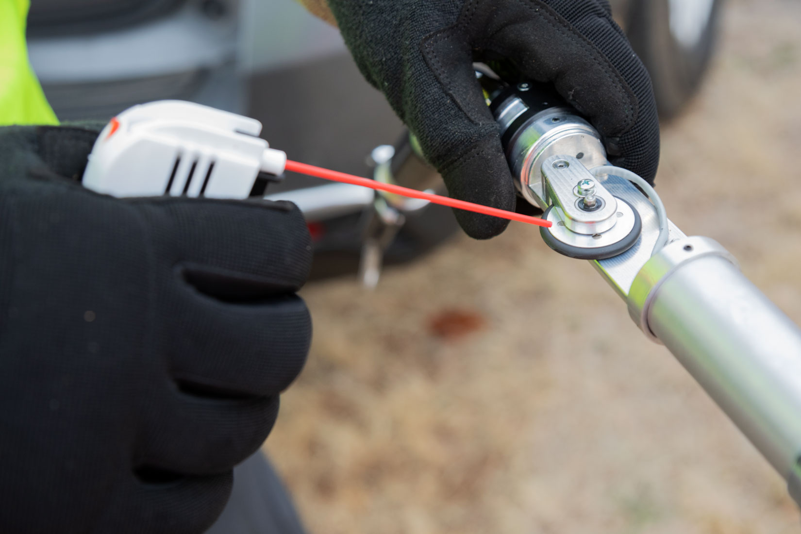
THE INTELLIGENT MAPPING™ ADVANTAGE
Most underground conduit remains undocumented, unverified, and invisible—creating risk, delays, and costly failures during construction and fiber installation. Intelligent Mapping is different because we capture true in-conduit geometry, including bend radius, and pair it with installation-critical insights such as pull tension limits and jetting requirements, producing accurate, audit-ready data you can trust. We turn unknown subsurface infrastructure into reliable, deployable assets so fiber installs succeed the first time and projects move faster with fewer surprises.
BUILT TO GIVE UTILITIES CLEARER DATA AND SMARTER DECISION-MAKING
EXISTING PIPE AUDITS
Across the United States, many empty or underutilized conduits and pathways exist within current infrastructure. Whether planned for reuse or transfer, their true condition and exact location are often unclear, creating the potential for unexpected costs and delays. With our device and software, these assets can be accurately audited, giving all stakeholders verified data on their condition and precise position to support confident planning and decision-making.
MAP THE LOCATION OF AN UNDERGROUND SYSTEM TO DETERMINE THE CONDITION OF THE PIPE.

NEW PIPE AS-BUILTS
ELIMINATE INSPECTION REQUIREMENTS AND DETERMINE THE PIPE WAS INSTALLED TO PLAN.
By utilizing the Intelligent Mapping software and device, along with a third-party inspection firm, teams can streamline their processes and receive accurate, unbiased data about their infrastructure, supporting clearer decisions and more efficient project planning.

BEND RADIUS
EVALUATE BEND RADIUS TO ENSURE NO PROBLEMS WITH INSTALLATION AND THAT A CABLE CAN PASS THROUGH THE PIPE.
By utilizing the Intelligent Mapping software and device, a vendor can pre-qualify the conduit before installation. If there is a violation, they can verify its location.

LOCATION DATA
One of the primary goals of early project planning is to minimize the need for relocations through early identification and communication with the design team, reducing claims and costly delays during construction. By utilizing the Intelligent Mapping software and device, designers can identify existing assets in the project path and locate infrastructure that may not be found by other methods, such as ground-penetrating radar or frequency locators.
REDUCE THE NUMBER OF POTHOLES AND INCREASE THE NUMBER OF LOCATES PER DAY TO HELP VERIFY DATA.